google.com, pub-1205142185266664 , DIRECT, f08c47fec0942fa0

Un viaggio virtuale in Valle d’Aosta

A virtual trip in Valle d’Aosta

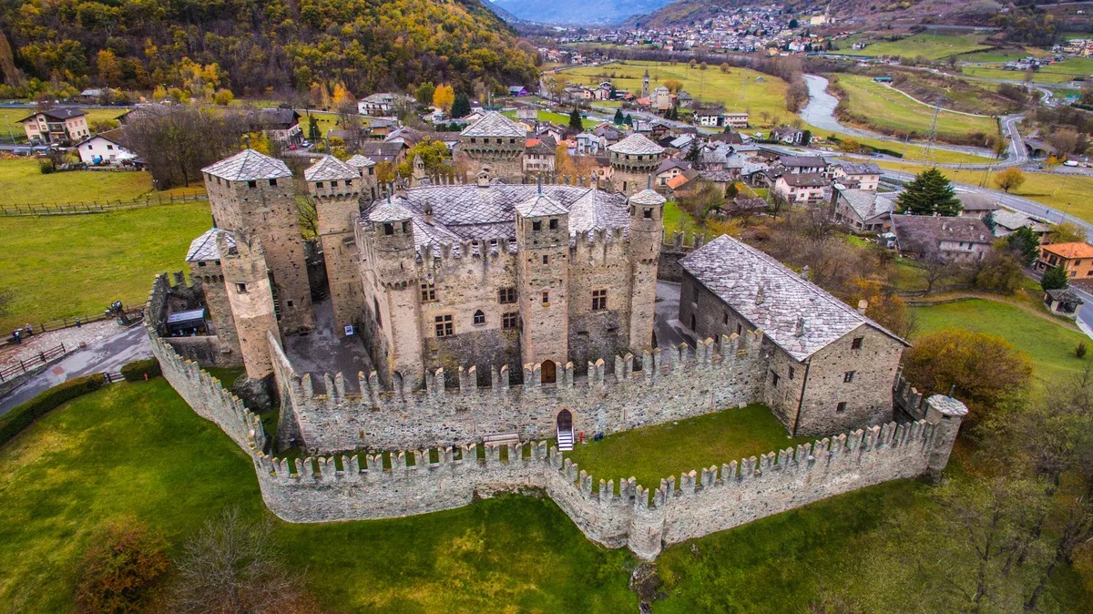
In Italia il mese di marzo è il tempo delle gite scolastiche, una pausa dagli studi in cui gli studenti italiani hanno la fortuna di esplorare la storia e la bellezza che li circonda. Sono grata ai miei genitori che mi hanno sempre permesso di parteciparvi. Una delle destinazioni più memorabili fu la Valle d’Aosta quando avevo 15 anni.

Ricordo l’emozione e l’incanto nel vedere i suoi paesaggi mozzafiato costellati da castelli meravigliosi. Con i compagni di scuola si faceva a gara a chi ne contava di più.

La Valle d’Aosta a differenza di molte altre regioni italiane gode di un turismo soprattutto italiano nel periodo sciistico.
Fammi sapere nei commenti se ci sei stata/o o se ti piacerebbe andarci!
Buon Viaggio!

In Italy, March is the time for school trips, a break from studies in which Italian students are lucky enough to explore the history and beauty that surrounds them. I am grateful to my parents who have always allowed me to participate. One of the most memorable destinations was the Aosta Valley when I was 15.
I remember the emotion and the enchantment of seeing its breathtaking landscapes dotted with wonderful castles. With my schoolmates, we’d competed to see who counted the most castles. Valle d’Aosta, unlike many other regions, enjoys mainly Italian tourism during the skiing period.
Let me know in the comments if you’ve been there or if you’d like to go! Buon Viaggio!

Valle d’Aosta | Montagne e castelli

Aosta Valley: Mountains And Castles

Un video aereo con drone della regione Valle d’Aosta, nel Nord Italia. Caratterizzato dal Castello di Graines in Val d’Ayas, situato nei pressi dell’omonimo paese nei pressi di Brusson.
Segue il Santuario della Madonna della Neve di Machaby, che si trova a 696 metri di altezza, nella valle di Machaby e poco distante dal centro di Arnad, in una splendida posizione tra le boschi di castagno.
Il prossimo è il Castello superiore di Arnad. Situato in una posizione dominante il villaggio, sul lato della valle di Machaby, il castello è attualmente in rovina.
Il prossimo punto di interesse è il famoso Castello di Bard, noto anche per la Fortezza dell’Hydra in Marvel’s Avengers, situato nella storica via che controlla il passo tra Italia e Francia in Valle d’Aosta (nord-ovest dell’Italia).
Infine, il Castello di Verres, fortificata nel XIV secolo nel sud della Valle d’Aosta. È stato definito uno degli edifici più imponenti del Medioevo della zona. Costruito come fortezza militare da Yblet de Challant nel XIV secolo, fu uno dei primi esempi di castello costruito come un’unica struttura piuttosto che come una serie di edifici racchiusi in una cinta muraria.

A cinematic aerial drone video of the Valle d’Aosta (Aosta Valley) region, in Northern Italy. Featuring the Castle of Graines in Val d’Ayas, located near the village with the same name near Brusson.The video is followed by the Shrine of the Madonna della Neve of Machaby (Madonna of the snow), which is located at a height of 696 metres, in the Machaby valley and not far from the centre of Arnad, in a splendid position among the chestnut forests.
Next is the Castello superiore di Arnad (Arnad’s superior castle). Situated in a position dominating the village, on the side of the Machaby valley, the castle is at present in ruins. 
The next point of interest shown is the famous Castello di Bard (Bard’s castle), also known for the Hydra Fortress in Marvel’s Avengers. It is situated in the historic route that controls the pass between Italy and France in the Aosta Valley (northwest of Italy).
Lastly, the Verres Castle (Castello di Verrès) is a fortified 14th-century fortress in the lower Aosta Valley. It has been called one of the most impressive buildings from the Middle Ages in the area. Built as a military fortress by Yblet de Challant in the fourteenth century, it was one of the first examples of a castle constructed as a single structure rather than as a series of buildings enclosed in a circuit wall.

La geografia della Valle d’Aosta in due minuti

The geography of Valle d’Aosta in two minutes

La geografia della Valle d’Aosta attraverso un utile tutorial nel quale lo studente sarà partecipe della costruzione modulare della regione con i suoi elementi.

The geography of the Aosta Valley through a useful tutorial in which the student participates in the modular construction of the region with its elements.

Valle d’Aosta, terra di castelli – versione completa

Valle d’Aosta, land of castles – full version

Panoramica completa dei castelli visitabili in Valle d’Aosta, corredata da interessanti spiegazioni storiche.

Complete overview of the castles that can be visited in Valle d’Aosta, accompanied by interesting historical explanations.

Valle d’Aosta, la strada è scavata tra muri di neve record

Valle d’Aosta, the road is carved between walls of record snow

Una massiccia nevicata nel dicembre del 2018 con muri di neve alti fino a 10 metri sulla strada che collega Italia e Francia attraverso il passo del Piccolo San Bernardo.
La Thuile, Porta Littoria durante il fascismo dal 1939 al 1946, è un comune italiano situato nel vallone di La Thuile, valle laterale della Valle d’Aosta. È il comune più occidentale della regione Valle d’Aosta ed è una rinomata stazione turistica invernale.

A massive snowfall in December 2018 with snow walls up to 10 meters high on the road connecting Italy and France via the Piccolo San Bernardo pass. La Thuile, Porta Littoria during fascism from 1939 to 1946, is an Italian town located in the La Thuile valley, a side valley of the Aosta Valley. It is the westernmost town in the Aosta Valley region and is a renowned winter tourist resort.
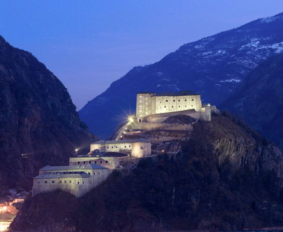
The castles, history and geography of Valle d'Aosta in Italy.
Castello di Bard, Valle d’Aosta

Scioglilingua basati sui numeri

Tongue twisters based on numbers

(English follows)

9 divertenti scioglilingua per allenare la lingua e la pronuncia italiana.

Infatti, gli scioglilingua, detti anche scioglilingue, sono delle frasi che mettono in difficoltà intenzionalmente la nostra capacità di pronunciarle. Con la pratica migliorano la dizione e le abilità oratorie.

Il bello degli scioglilingua è sfidare sè stessi a pronunciarli il più velocemente possibile senza fare errori… ma il divertimento sta proprio quando si inciampa e ci si aggroviglia tra le parole.

Questa prima lista comprende gli scioglilingua basati sui numeri, ma ne seguiranno altre categorie nelle prossime settimane per occupare la lingua e  non solo mangiare. 🙂

Dai, prova anche tu da solo o insieme ai tuoi amici via zoom…

9 fun tongue twisters to train the Italian language and pronunciation.

In fact, tongue twisters, are phrases that intentionally challenge our ability to pronounce them. With practice they improve diction and speaking skills.

The beauty of tongue twisters is to challenge yourself to pronounce them as quickly as possible without making mistakes … but the fun is when you stumble and get tangled in words.

This first list includes number-based tongue twisters, but other categories will follow in the coming weeks to occupy the tongue and not just eat. 🙂

Come on, try it yourself or with your friends via zoom …

1. Due tazze strette in due strette tazze

2. Tre stecchi secchi in tre strette tasche stanno.

3. Tre fiaschi stretti stan dentro tre stretti fiaschi, ed ogni fiasco stretto sta dentro lo stretto fiasco.

4. Tré tozzi di pan secco in tré strette tasche stanno in tré strette tasche stan tré tozzi di pan secco

5. Sopra quattro rossi sassi quattro grossi gatti rossi.

6. Sette zucche secche e storte stanno strette dentro al sacco

7. Stanno stretti sotto i letti sette spettri a denti stretti.

8. Nove navi nuove navigavano.

9. Nell’anfratto della grotta trentatré gretti gatti si grattano

Clicca sui seguenti link per esercitarti con alcuni degli scioglilingua italiani più famosi / Click on the following links to practice some of the most popular Italian tongue twisters:


Un viaggio virtuale in Abruzzo

A virtual trip in Abruzzo

Inizio la mia serie mensile di viaggi virtuali attraverso le regioni italiane con l’Abruzzo, una regione che conosco molto bene condividendo il territorio e quindi le tradizioni e la propria storia con il Molise, la terra dove affondono le mie radici.

Infatti fino al 1963 l’Abruzzo e il Molise erano unite secondo la Costituzione italiana per poi avere i territori separati in due distinte regioni.

Dell’Abruzzo mi piace la natura incontaminata e i simpaticissimi cervi!

E’ una regione che protegge la propria natura e la propria cultura pur restando competitiva con le altre regioni a livello economico.

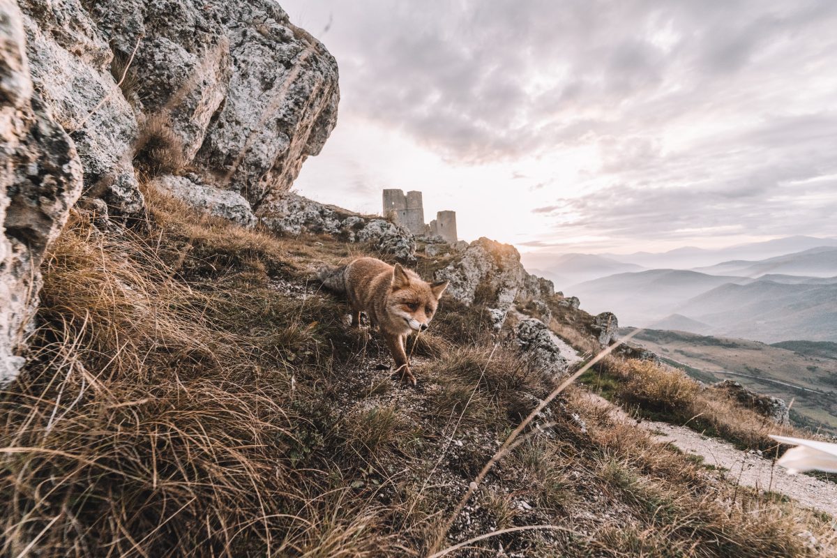
Il volpino nella foto sembra contento e indaffarato nelle sue avventure sugli Appennini abruzzesi.

Iniziamo questo bel giro tra gli appennini, il mare, i parchi, le grotte,….

Buon viaggio!

(Se hai visitato l’Abruzzo condividi il tuo viaggio nei commenti con storie e foto!)

I’m starting my monthly series of virtual trips through the Italian regions with Abruzzo, a region that I know very well as it shares its territory and therefore traditions and history with Molise, the land where my roots lie.
In fact, until 1963 Abruzzo and Molise were united according to the Italian Constitution and then their territories were separated into two distinct regions.
I like the unspoiled nature of Abruzzo and the simpaticissimi deer!
It’s a region that protects its nature and culture while remaining competitive with other regions on an economic level. The volpino/little fox in the photo seems happy and busy in his adventures on the Abruzzo Apennines.
Let’s start this beautiful tour among the Apennines, the sea, the parks, the caves, …. Buon Viaggio!

(If you have visited Abruzzo, share your trip in the comments with stories and photos!)

Paesaggi d’Abruzzo – Un viaggio alla scoperta dell’Abruzzo.

Un viaggio alla scoperta dell’Abruzzo attraverso l’occhio di fotografi e fotoamatori.

A journey to discover Abruzzo through the eyes of photographers and photoamateurs.

120°anniversario della “Transiberiana d’Italia”

In occasione dei 120 anni della ferrovia Sulmona-Carpinone, Fondazione FS ha organizzato una spettacolare manifestazione della durata di tre giorni, che ha visto impegnato diverso materiale storico lungo le impegnative rampe della linea. Ben tre convogli si sono avvicendati durante l’evento, che ha permesso di conoscere una linea ferroviaria di montagna del centro Italia con ambienti di rara bellezza paesaggistica.

On the occasion of the 120th anniversary of the Sulmona-Carpinone railway, Fondazione FS organized a spectacular event lasting three days, which involved various historical material along the demanding ramps of the line. Three convoys took turns during the event, which was made possible to get to know a mountain railway line in central Italy with landscapes of rare scenic beauty.

Grotta Grande dei Cervi e Ovito di Pietrasecca – Abruzzo

Esplorata nel marzo del 1984 dal GS CAI Roma, in seguito all’ individuazione, da parte di P. Giaffei, di una nicchia nella roccia in gran parte occupata da una frana. Un lungo lavoro di scavo ha consentito, dopo alcuni giorni, di aprire il cunicolo d’ingresso. […] Nelle settimane successive è stata completata l’esplorazione”. Così recita il libro “Grotte del Lazio“.

“Explored in March 1984 by GS CAI Rome, following the identification, by P. Giaffei, of a niche in the rock largely occupied by a landslide. A long excavation work allowed, after a few days, to open the entrance tunnel. […] In the following weeks the exploration was completed ”. So says the book, “Caves of Lazio”.

Viaggio nei luoghi dannunziani IN ABRUZZO

Uno straordinario percorso tra i luoghi dannunziani. Rappresentazioni visive e parole viaggiano assieme per accompagnarci tra i tanti volti di un Abruzzo che, anche grazie ai segni letterari lasciati dal poeta Gabriele d’Annunzio, continua a stupire e incantare.

An extraordinary journey through D’Annunzio’s sites. Visual representations and words travel together to accompany us among the many faces of the Abruzzo region which, also thanks to the literary marks left by the poet Gabriele d’Annunzio, continues to amaze and enchant.

Abruzzo e Molise

Un documentario alla scoperta dell’Abruzzo e del Molise.

A documentary to discover Abruzzo and Molise.

Abruzzo: 5 luoghi imperdibili

Dagli antichi Trabocchi alle leggende del Castello delle Fiabe di Roccascalegna, passando per Laghi a forma di Cuore, Borghi medioevali incantati e sorgenti purissime.

From the ancient Trabocchi to the legends of the Fairytale Castle of Roccascalegna, passing through Heart-shaped lakes, enchanted medieval villages and pure springs.


Il giardinetto dei mandala

Un progetto dedicato alla memoria di mio padre e ai suoi bellissimi giardinetti. A project dedicated to the memory of my father and to his beautiful gardens

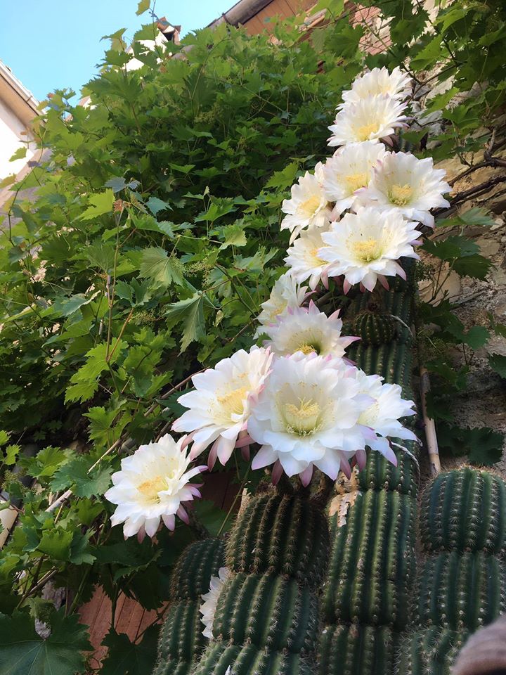
Il cactus fiorito di mio padre / My father’s cactus in bloom. – foto: Leo Colalillo

English follows –

In queste ultime settimane ho trovato molto conforto nel disegnare visto che la lucidità per esprimermi in parole mi mancava.

Per alcuni dei miei disegni mi sono ispirata ai giardinetti di mio padre che quest’anno, la prima estate senza di lui, sono fioriti da soli in tutto il loro splendore. 
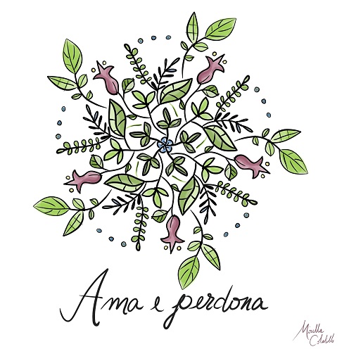
Ho disegnato dei mandala fioriti.

Pare che l’Italia si stia rialzando e tra un mese finalmente sarò lì.
Spero che potrò dire che dopo quest’apocalisse le cose cambieranno finalmente per il meglio nel bel paese. Chi vivrà vedrà.

Nel frattempo continuerò a disegnare mandala e a trovare ispirazione nei fiori.

In the last few weeks I have found a lot of comfort in drawing since I was missing the clarity to express myself in words.
For some of my drawings I was inspired by my father’s gardens ”giardinetti” which this year, the first summer without him, have bloomed alone in all their splendor.
I designed flowery mandalas.
It seems that Italy is getting back up and in a month I will finally be there.

I hope I can say that after this apocalypse things will finally change for the better in the beautiful country ”bel paese”. Time will tell.

In the meantime, I will continue to draw mandalas and to find inspiration in flowers.

Con affetto, Mirella


Altri articoli da leggere / More articles to read:

Pedalando i luoghi del ciclismo

In quest’articolo mio fratello ci parla della sua passione per il ciclismo e della scoperta dei magici luoghi italiani del ciclismo. Il titolo “Pedalando i luoghi del ciclismo” non è di facile traduzione in inglese. Mentre sarebbe facile in francese “En pédalant les lieux du cyclisme”.
Azzardiamo con
“Mountains, cycling, and fresh air in Italy?” 😃

In this article my brother talks about his passion for biking and the discovery of the magical Italian places of cycling. The title “Pedalando i luoghi del ciclismo” is not easy to translate into English. While it would be easy in French “En pédaler les lieux du cyclisme”.
Shall we dare with “Mountains, cycling, and fresh air in Italy?”
😃

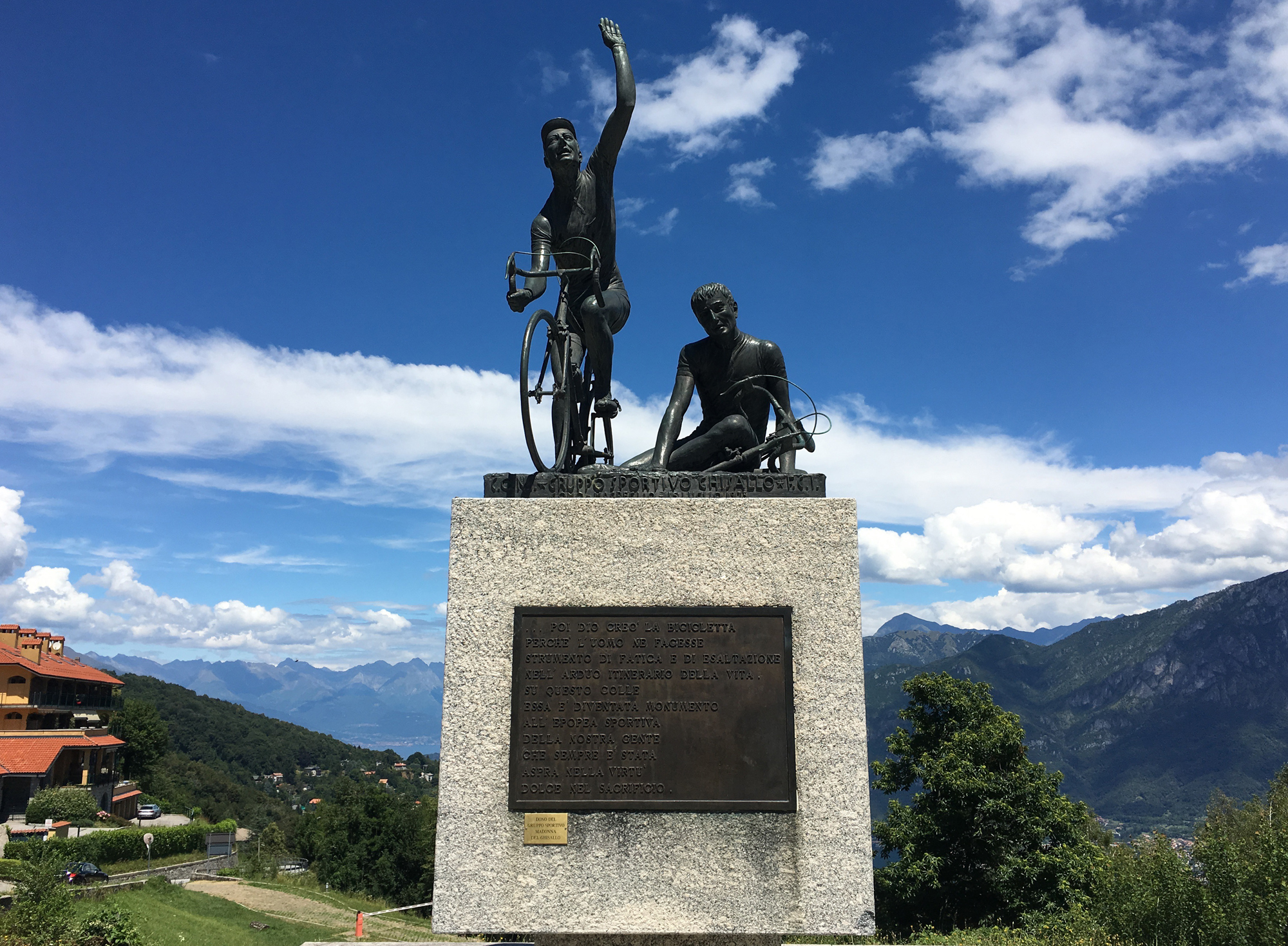
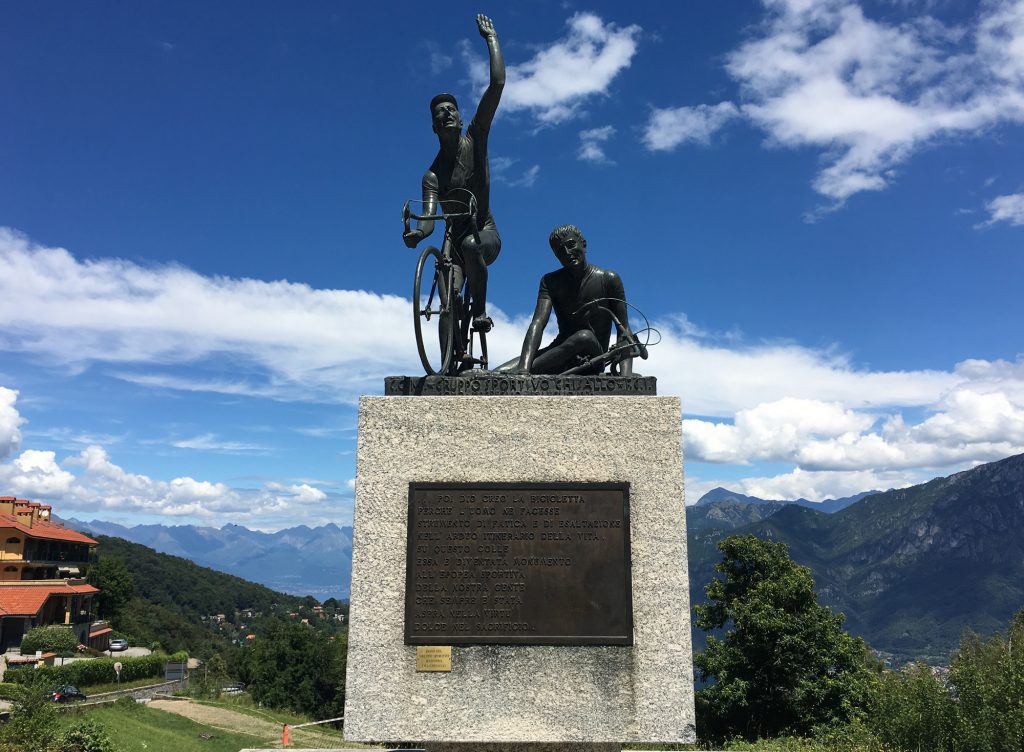
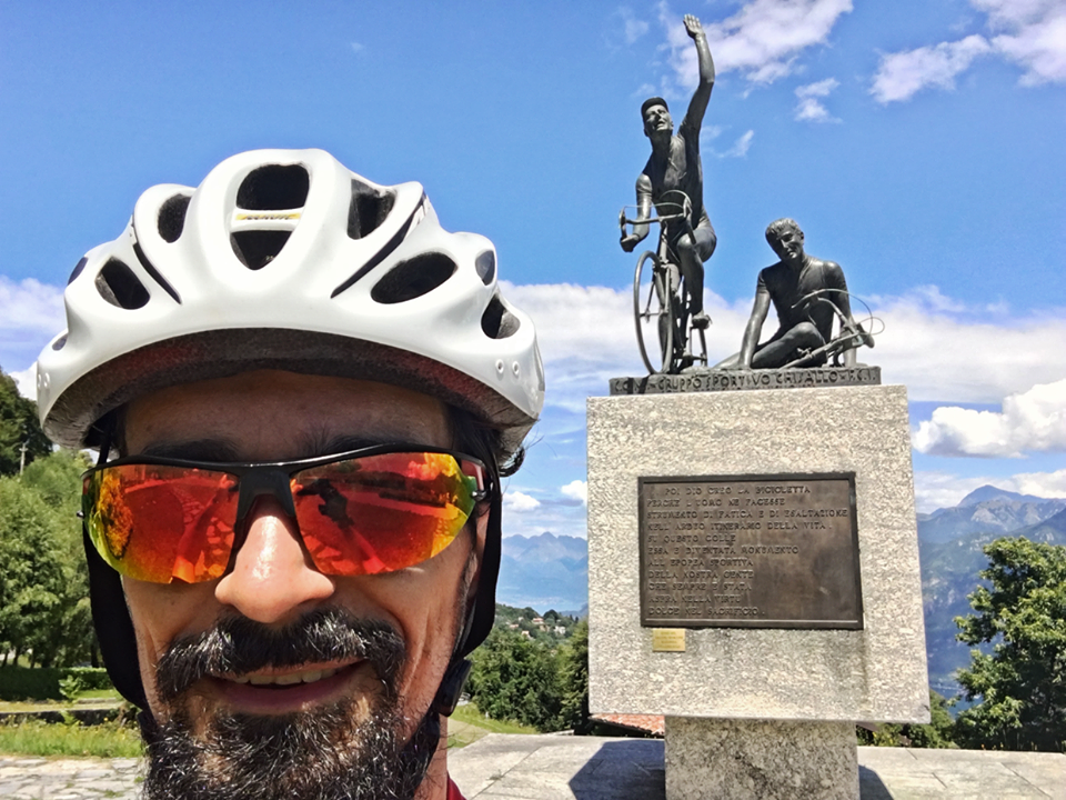
Monumento al ciclista sul Ghisallo © Leo Colalillo

Quest’anno l’estate proprio non vuole arrivare e forse neanche la primavera, dicono che sia stato il maggio più freddo dal 1957, nello stesso periodo in cui si è svolto uno degli eventi ciclistici più importanti del mondo, il Giro d’Italia.

This year summer just doesn’t want to come and perhaps not even spring, they say it was the coldest May since 1957, and during that same period, one of the most important cycling events in the world took place, il Giro d’Italia.

Come è noto, il Giro d’Italia attraversa i posti più belli d’Italia soprattutto montani, e quest’anno la tappa che prevedeva il passo Gavia non si è svolta. Parliamo di una salita di circa 26km che da Bormio (1.220m s.l.m.) sale fino a 2.621 s.l.m ed è tuttora coperta di neve.

As many know, il Giro d’Italia crosses the most beautiful places in Italy, especially those in the mountains, and this year the stage that included il passo Gavia did not take place. We’re talking about a slope of about 26km which from Bormio (1.220m above sea level) rises up to 2.621m and is still covered with snow.

© Carlo Gironi – Stelvio 9 Giugno 2019

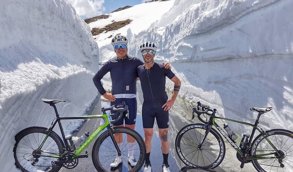
Io ancora non mi sono misurato con il passo Gavia nè con lo Stelvio (foto sopra), ma probabilmente lo farò durante questa estate, perché prima o poi la neve si scioglierà dato che un paio di settimane fa è arrivato il primo giorno caldo di questo lungo inverno. In quei giorni mi sono detto che dovevo affrontare una di quelle salite leggendarie, per chi ama fare sport ed andare in bici. Quel giorno inoltre decido di incontrarmi con altri amici per fare una sgambata di gruppo.

I haven’t yet measured myself with il passo Gavia nor with lo Stelvio (pictured above), but I will probably do it this summer, because sooner or later the snow will melt having the first hot day of this long winter arrived a couple of weeks ago. I told myself then that I had to tackle one of those climbs which are legendary for those who love sports and cycling. That day I also decided to meet with other friends to do a group ride.

Chilometro dopo chilometro capisco presto che abbiamo obiettivi diversi e la mia indole solitaria ottiene la meglio, ma in quei chilometri penso anche che quest’anno mi sono allenato poco e con la bici è meglio non esagerare. Avevo all’orizzonte il mio secondo Triathlon della stagione, quindi un allenamento in buona compagnia sarebbe stata una scelta saggia.

Kilometer after kilometer I soon understand that we have different objectives and my solitary nature prevails , but in those kilometers I also think that this year I have trained little, and it’s better not to overdo it with my bike. I had my second Triathlon of the season on the horizon, so a workout in good company would be a wise choice.

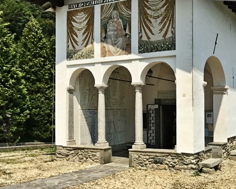
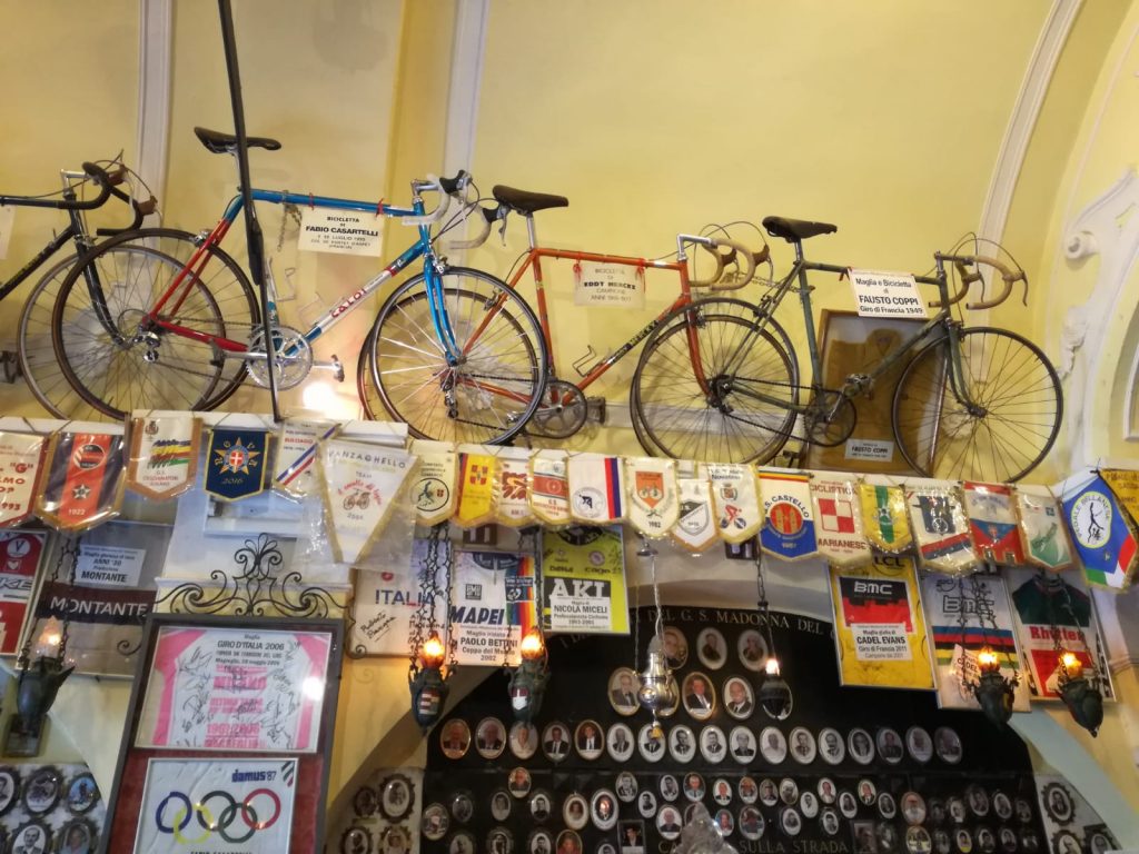
Ci dirigiamo come succede spesso in una zona dove molti ciclisti lombardi si allenano, il così detto Triangolo di Lariano, che è la penisola fra i due rami del lago di Como. Questa zona presenta strade un po’ per tutti i gusti e salite di difficoltà diverse, come il Ghisallo, tappa obbligata per i ciclisti e storica salita che ha reso celebre il Giro d’Italia. Qui si trova anche il Santuario della Madonna del Ghisallo, una piccola chiesa dove ai lati della cappella sono esposte le bici di leggende del ciclismo come Coppi, Bartali, Gimondi, ed altri.

We head as often happens in an area where many Lombard cyclists train, the so-called Triangolo di Lariano, which is the peninsula between the two branches of Lake Como. This area has roads for all tastes and slopes of different degrees, such as Ghisallo, a must for cyclists and a historic slope that made il Giro d’Italia famous. Here you will also find the Sanctuary of the Madonna del Ghisallo, a small church on the sides of the chapel where the bikes of cycling legends are exhibited such as Coppi, Bartali, Gimondi, and others.

Santuario della Madonna del Ghisallo © Leo Colalillo

Dunque siamo in una bellissima zona, fra verde e laghi e ci fermiamo tutti insieme dopo 40km per bere e ricaricare le borracce. Alla ripartenza dopo solo qualche km vedo un’insegna: c’è scritto Sormano. Non ero sicuro che saremmo passati di lì, mi guardo alle spalle poi guardo avanti e decido in pochi secondi di abbandonare il gruppo per proseguire in solitaria.

So we are in a beautiful area, between green landscapes and lakes and we all stop together after 40km to drink and recharge our water bottles. When we restart, after only a few km I see a sign: it says Sormano. I wasn’t sure we would have gone by there, I look over my shoulder and I look ahead and decide in a few seconds to leave the group to go on alone.

È da troppo tempo che voglio fare questo percorso famoso per la sua durezza e che conduce ad un mostro sacro, il Muro di Sormano, una delle salite più dure del mondo. Curva dopo curva salgo, la salita introduttiva, che porta al muro, mi sembra abbordabile, non è troppo difficile, basta tenere il passo giusto senza esagerare, ma ad un tratto vedo l’insegna che mi indica che da quella parte inizia il Muro di Sormano. Faccio una piccola pausa di riflessione per apprezzare anche l’insegna storica che indica il percorso, quindi inforco la bici e riparto. Dopo una brevissima discesa di qualche decina di metri, la salita del Muro mi viene incontro e si presenta già durissima. Per quanto i giorni prima ci avessi pensato non avevo pianificato di farla proprio in quel momento, quindi la mia preparazione non era adeguata, ma pedalata dopo pedalata vedo che riesco ad avanzare.

For too long I have wanted to undertake this route renowned for its difficulty and which leads to a sacred monster, il Muro di Sormano (the Wall of Sormano), one of the toughest slopes in the world. Curve after curve I climb the introductory slope, which leads to the wall and seems doable to me. It’s not too difficult, as long as I keep up the pace without exaggerating, but suddenly I see the sign that indicates that il Muro di Sormano starts over there. I take a little break to reflect and to appreciate the historical sign indicating the route, then I get on the bike and keep going. After a very short descent of a few metres, the slope of the wall comes towards me and it’s already very hard. Although I had thought about it days before , I hadn’t planned to do it right then, so my preparation wasn’t adequate, but after pedaling I see that I’m able move forward.

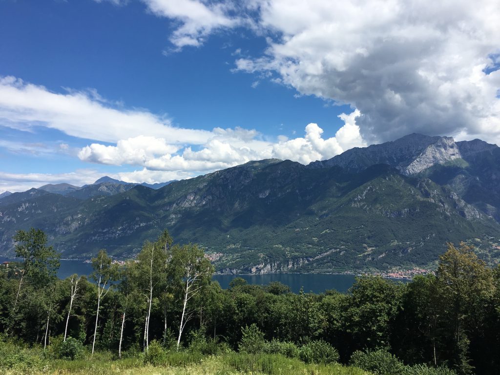
Vista dal Ghisallo verso il Lago di Como © Leo Colalillo

Il Muro di Sormano divenne famoso nel 1960 quando venne inserito nel Giro di Lombardia, infatti durante la salita sull’asfalto sono impresse frasi ed informazioni legate alla salita stessa. Negli ultimi anni tale salita fa parte anche del durissimo Giro del Demonio, evento annuale che si svolge sempre nel Triangolo di Lariano, che prevede le più dure salite della zona.

Il Muro di Sormano became famous in 1960 when it was included in il Giro di Lombardia, in fact during the climb you’ll see written on the asphalt sentences and information related to the climb itself. In the last few years this slope is also part of the very hard Giro del Demonio, an annual event that always takes place in the Triangolo di Lariano, which includes the toughest climbs in the area.

Mi fermo alcuni secondi per riprendere le energie e capire se quello sarà il giorno giusto per arrivare in cima. Con una certa caparbietà mi rimetto in sella e continuo. Date le pendenze, è molto difficile riprendere il ritmo senza rischiare di cadere. Gambe e fiato ci sono, ma la salita sembra lunghissima, non avendo pianificato nulla, non ricordavo esattamente quale fosse la lunghezza del Muro. Mi fermo ancora una volta e decido che è l’ultima pausa, intanto vedo i numeri segnati sull’asfalto e che indicano l’avvicinarsi della vetta, ma i picchi di oltre 20% di pendenza si facevano sentire e la bici scricchiola.

I stop a few seconds to regain my energy and understand if that will be the right day to reach the summit. With a certain stubbornness I get back in the saddle and continue. Given the gradients, it’s very difficult to pick up the pace without risking to fall. My legs and breath are keeping up, but the climb seems very long not having planned anything and not remembering exactly what the length of the Wall was. I stop once more and decide that it’s the last pause, meanwhile I see the numbers on the asphalt that indicate I’m approaching the summit, but I can feel the peaks of more than 20% gradient and the bike is creaking.

Leo davanti al Monumento al ciclista sul Ghisallo © Leo Colalillo

Dopo l’ultimo tornante vedo un cancello di legno e capisco che l’odissea di quasi 2km è finita. Sì, solo 2km che per i più allenati si percorrono in 15′-20′. Arrivo al cancello, scendo bevo, mangio e mi godo il panorama pensando alla salita appena affrontata, alle sensazioni e ai pensieri, capendo che questa non sarà l’ultima volta.

È solo un arrivederci!

After the last hairpin bend I see a wooden gate and I understand that the odyssey of almost 2km is over. Yes, it’s only 2km which for the more trained cyclists can be completed in 15′-20′. I reach the gate, I get off the bike, I drink, I eat, and I enjoy the landscape thinking of the climb I just confronted the sensations and thoughts, realizing that this will not be the last time.

It’s just a goodbye!

2 Giugno 2019 (Muro di Sormano) © Leo Colalillo

Leo Colalillo è un designer grafico laureato con la Lode all’Istituto Europeo del Design di Roma. Lavora tra Roma e Milano. I suoi lavori si trovano su MyFonts e sono pubblicati su Typodarium (2016, 2017, 2019).
Web: http://leocolalillo.com/


Leo Colalillo is a graphic designer graduating with honors at the European Institute of Design in Rome. He works between Rome and Milan. His works can be found on MyFonts and are published on Typodarium (2016, 2017, 2019).
Web: http://leocolalillo.com/


Scopri tutti i miei articoli recenti ~ discover all my recent articles:

Stromboli: il faro del mediterraneo/the lighthouse of the Mediterranean

The real danger is the “sphere of fire” enclosed in the crust of the volcano.

Article by MARIO TOZZI, 03 July 2019 “La Stampa
Translated by Mirella Colalillo

Original article in Italian: https://www.lastampa.it/2019/07/03/news/stromboli-quella-finestra-aperta-nbsp-sulle-viscere-della-terra-1.36637890

foto da “il Corriere della Sera”

Of the five hundred and more active volcanoes in the world, there is only one that can be trusted, because it has been erupting since the Sapiens crossed in the Tyrrhenian Sea and because it rarely caused pain. Even when the island became depopulated due to a stronger eruption than the others in 1930, going from 3mil inhabitants to the current 400. That volcano is Stromboli, the lighthouse of the Mediterranean. This time, though, it’s one of those. And it is also why Stromboli can be very loved or very hated, hardly its fault. It is enough to know its history, even when, as in this case, the meticulous surveillance to which the volcano is subjected has not given way to foresee a paroxysm which, it’s believed, should remain isolated.

In Stromboli, on average every 5-15 years, the paroxysmal explosive phenomena and the landslides that trigger tsunamis cause damage to people and things. Normally the Strombolian activity proceeds by modest jets of water vapor (the gas columns are white, a sign that ash is not erupted) that hurl into the air small incandescent fragments originated by the gas bubbles that arrive at the top of the magmatic column every 20 minutes or so . Sometimes the lava fountains reach a thousand meters in height and can be seen from far away, especially at night when other landmarks are missing. For this reason Stromboli is the lighthouse of the Mediterranean, known by Greeks and Phoenicians, by Romans and Punic people, as a friend.

The volcano has been more or less the same for at least ten thousand years, but its history begins with the activity of Strombolicchio (the rock in front of Stromboli, remnant of a volcanic chimney) about 200,000 years ago and continues with four eruptive periods. One hundred thousand years ago there was a Paleostromboli that erupted lavas, but above all ashes, both fallen and from dangerous pyroclastic flows (burning and fast aerosols), and mudslides: no man has observed their birth up close. Subsequently the volcano produced more lavas than ashes, lavas that continued in the period immediately preceding the so-called recent Stromboli, namely that of the Sciara del Fuoco, the great landslide escarpment on the side of the volcano, and of an activity so typical that it gave its name to all similar eruptions in every part of the world (precisely “Strombolian”). Also the lavas have changed: initially they were much richer in silica, today they are more similar to basalts with high potassium contents.

As in 1879, 1916 and 1919, and also as in 1944, in 1954 and 2002, Stromboli’s paroxysms caused limited tsunamis. They are quite frequent phenomena also for the history of men: nothing to do with the gigantic tsunamis that could be caused by the collapse of the huge sub-Tyrrhenian submarine volcanoes such as Marsili, linked however to completely different dynamics and, at the moment, not dangerous. The history of Stromboli is made up of huge landslides, some explosion and collapsing waves, as well as lava fountains and gas clouds.

Stromboli concels its possible danger in its depths. If we lifted the thin superficial crust film, Stromboli would show us its heart of darkness: a superficial magma chamber brought to light by a tomography performed by the Ingv: a kind of fiery sphere of 150 meters of radius placed at about 700 m of altitude and fed by ducts that fish much deeper. What would happen if a large landslide took away an important slice of mountain and plunged it into the sea? The denudation of the hot heart of the volcano would have catastrophic consequences.


Video of the explosion a few meters away:

https://video.lastampa.it/cronaca/l-esplosione-a-stromboli-vissuta-da-pochi-metri-di-distanza/101066/101066


The volcanism of Stromboli depends on a single cause, the clash that takes place in the lower Tyrrhenian between Africa and Europe, two of the largest geological plates on planet Earth. In reality the collision has lasted for millions of years, but the collision processes between the continents are discontinuous, and the crises are linked to the slow “digestion”, on the part of the Earth’s mantle, of the African plate that knee bends just below the Aeolian islands to be reabsorbed under the European one. Efforts generated by friction trigger earthquakes ranging from twenty to over four hundred kilometers in depth. Not only: the plaque that bends finds deeper and higher temperatures and therefore melts, generating the magmas that feed the Aeolian volcanoes.

But anyone who knows Stromboli, knows that the top of the island (ie the volcano) is constantly affected by small explosions that make a lava pour out not too viscous nor too fluid along with a characteristic cloud of whitish vapor. When I climb Stromboli I trust it and we should continue to do so. Provided you do not forget that it is a volcano, a window open on the inside of the Earth. Never be afraid of a volcano, just have respect and love for Mother Earth. Despite the pain of today. –

Vocabolario – Vocabulary:

il vulcano: the volcano
l’eruzione: the eruption
i fenomeni esplosivi: the explosive phenomena
la scarpata di frana: the landslide slope
i maremoti: the tsunamis / agitated waters
l’attività stromboliana: Strombolian activity
i frammenti incandescenti: the glowing fragments
le fontane di lava: the lava fountains
le colate di fango: the mudslides
le ceneri: the ashes
le nubi di gas: the gas clouds
la nube di vapore: the steam cloud
il vapore acqueo: the water vapor
le placche geologiche: the geological plates
il mantello terrestre: the Earth mantle
il terremoto: the earthquake
fuoriuscire: to pour out
la Madre Terra: the Mother Earth


Non hai ancora comprato il mio libro? Cosa aspetti!
Clicca qui per avere uno sconto
!

Haven’t you got my ebook yet? What are you waiting for?
Click here to get a discount!

You cannot copy content of this page